May 30, 2025 | 17:58 GMT +7
Hotline: 0913.378.918
![]()
May 30, 2025 | 17:58 GMT +7
Hotline: 0913.378.918
![]()

A motorist watches as a wildfire burns on the side of a mountain in Lytton, Canada on July 1, 2021. AP
The majority of the strikes across British Columbia were the result of pyrocumulonimbus clouds, which formed when the blazing heat and billowing smoke from the fires rise skyward, Business Insider reported.
The thunderheads in cumulus clouds produce their own weather, including tornadoes in some cases, which can then spark new fires in a vicious cycle, according to the news outlet.
Dakota Smith, a meteorologist at Colorado’s Cooperative Institute for Research in the Atmosphere, said in a tweet that he observed “absolutely mind-blowing wildfire behavior in British Columbia.”
He included satellite images from above Lytton earlier this week and added: “incredible & massive storm-producing pyrocumulonimbus plumes.”
Daniel Swain, a climatologist with the Institute of the Environment and Sustainability at UCLA, wrote on Twitter: “I’ve watched a lot of wildfire-associated pyroconvective events during the satellite era, and I think this might be the singularly most extreme I’ve ever seen.”
He added: “This is a literal firestorm, producing *thousands* of lightning strikes and almost certainly countless new fires.”
Another name for the “fire clouds” is cumulonimbus flammagenitus, according to NASA, which also refers to the pyrocumulonimbus storms as the “fire-breathing dragon of clouds.”
Thunderstorms normally form when warm, moist air rises into the sky. As it enters the lowest part of the atmosphere, the air cools and sinks closer to the ground, where it warms up and rises again.
That cycle of convection creates cumulonimbus, or thunder, clouds – but when that heat and moisture rise from a smoky wildfire the convection creates pyrocumulonimbus clouds, according to the news outlet.

A wildfire burns in the mountains north of Lytton, British Columbia, on July 1, 2021. AP
In addition to rain, these clouds often unleash powerful blasts of dry air known as “downbursts,” rather than water droplets – and scatter a embers and smoke across great distances.
That fuels the flames that originally generated the storm, according to the report.
And if the convecting air in a pyrocumulonimbus cloud forms a swirling, circular column, the storm can also spawn a spectacular “fire tornado,” Business Insider reported.
Chris Vagasky, a meteorologist with Vaisala, which tracks lightning strikes around the world, told SFGATE.com that the North American Lightning Detection Network sensed 710,177 strikes across British Columbia and northwestern Alberta over the course of about 15 hours in recent days.
(NYP;AP)

(VAN) Vikas Rambal has quietly built a $5 billion business empire in manufacturing, property and solar, and catapulted onto the Rich List.
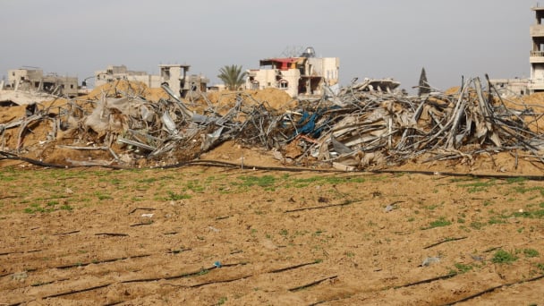
(VAN) Available cropland now at less than five percent, according to latest geospatial assessment from FAO and UNOSAT.
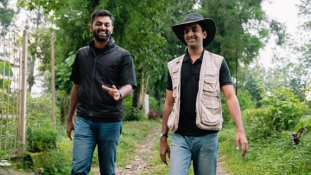
(VAN) Alt Carbon has raised $12 million in a seed round as it plans to scale its carbon dioxide removal work in the South Asian nation.

(VAN) Attempts to bring down the price of the Japanese staple have had little effect amid a cost-of-living crisis.

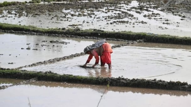
(VAN) Fourth most important food crop in peril as Latin America and Caribbean suffer from slow-onset climate disaster.

(VAN) Shifting market dynamics and the noise around new legislation has propelled Trouw Nutrition’s research around early life nutrition in poultry. Today, it continues to be a key area of research.
(VAN) India is concerned about its food security and the livelihoods of its farmers if more US food imports are allowed.
