May 19, 2025 | 01:53 GMT +7
Hotline: 0913.378.918
![]()
May 19, 2025 | 01:53 GMT +7
Hotline: 0913.378.918
![]()

Mr. Nguyen Huu Thien, an independent ecological research expert in the Mekong Delta. Photo: Le Hoang Vu.
Vietnam Agriculture Newspaper had an interview with Mr. Nguyen Huu Thien, an independent ecological research expert in the Mekong Delta, about this issue.
Sir, what is the reason why the Mekong Delta has increasingly severe landslides on both sides of the river?
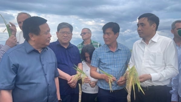
In 13 provinces and cities in the Mekong Delta, there are currently 555 riverbank erosion locations. Of these, 81 are hazardous landslide locations, and 137 are dangerous landslide locations. An Giang, Dong Thap, Can Tho, Vinh Long, and Hau Giang are hot landslide spots. The scope and speed of landslides are substantial, threatening the lives and property of the state and people.
Lack of alluvium is one of the main reasons why landslides are becoming more serious. Previously, each year, the Mekong Delta received 140 - 160 million tons of alluvium from the Mekong River, ranking 10th in the world in terms of alluvial load.
Talking about riverbank landslides there are two types of landslides: geological landslides and accelerated landslides. Geological landslides are natural phenomena. Any natural river does not stand still and continuously adjusts its flow due to other natural fluctuations locally and throughout the basin, such as weather, climate, and terrain. Human activities contribute to accelerated landslides.
The Mekong Delta is the product of transporting and accreting alluvium and sand over the past 6,000 years. During that process, there are still landslides and natural geological accretion. As the folk saying of our grandparents leaves behind, "the river erodes and accumulates". However, in that process, even though there were landslides here and deposits there, the Mekong Delta was still expanding, moving towards the East Sea at an average of 16m/year and towards Ca Mau Cape at an average of 26m/year. That was in the old days when the Mekong River diligently brought about 160 million tons of fine silt into the water every year, and about 30 million tons of sand drifted to the bottom of the river.

In 13 provinces and cities in the Mekong Delta, there are currently 555 riverbank landslides. Photo: Le Hoang Vu.
When hydroelectric dams gradually appeared upstream, including on the mainstream and tributaries of the Mekong River, the amount of silt and sand reaching the Mekong Delta gradually decreased, and landslides began to increase in the Mekong Delta, including on riverbanks and seashores. In addition, sand mining is taking place aggressively along the length of the river in all countries, most of which are in Cambodia and the Mekong Delta. 2005 can be considered an equilibrium point when total landslides and total sedimentation in the delta are equivalent. From 2005 until now, sedimentation has decreased rapidly, and landslides have accelerated, becoming more and more intense.
Thus, the leading cause of the widespread landslide phenomenon of nearly 1,000km of river banks and delta coasts is the lack of the source of materials that created this delta. Lack of sand makes the river bottom deeper and the banks higher and heavier, making them more likely to collapse.
In the context of a severe lack of silt and sand, the river bank and coastal erosion in the Mekong Delta will continue to become more serious in the next few decades. What is the current response so that landslides will be reduced or stopped?
The question is how to respond to minimize damage. Here, we try to analyze the pros and cons of some response measures. Structural measures have the advantage of being fast-acting and can protect several places for a period of time.
However, this measure has a series of disadvantages. Construction methods are costly. We will never have enough money to keep chasing the landslide situation with construction measures. Second, intervention in one place will cause landslides elsewhere because the river will seek dynamic balance.
Third, landslides are caused by a shortage of sand, and the more construction is done, the more sand there is, creating a vicious cycle. Fourth, every project has a lifespan. No project is eternal. Buildings need maintenance, and this cost increases with the age of the building. Measures to regulate and direct the flow away from the eroded bank may be effective, but there is a risk of causing landslides on the other bank. Suppose you only dredge to direct the flow without having solid structures on the river bottom to bear the force. In that case, the flow will continue to attack to return to the old direction, but building solid structures on the river bottom to stabilize the flow is very important.

Lack of alluvium is one of the main causes of increasingly serious landslides. Photo: Le Hoang Vu.
Therefore, construction measures should not be widespread but only in critical places such as densely populated areas, urban areas, and essential infrastructure. There should be a thorough economic analysis to weigh the benefits and costs of response options, including the probability of structural failure.
Soft measures such as planting cork along the river can cause sedimentation and protect river banks. The advantage of this method is that it is cheap, ecologically suitable, and creates habitat for aquatic species.
As severe landslides in the Mekong Delta will continue, the urgent thing to do is relocate people from places with high risks. Relocating early will be less costly and cause less loss of life and property than relocating after the landslide.
Relocating people is a big challenge because it requires land funds for resettlement, budget support, and vocational training for people to stabilize their livelihoods in the new place.
So, in this context, how should people be warned about landslides early, and how should people be evacuated early from landslide areas?
Regarding early warning work, our current way is to rely on academic scientific research to measure complex parameters, such as geology. - depth, velocity, discharge, silt content, soil structure, cohesion, stable slope... then put it into the computer model, write a scientific report, pass the project acceptance committee, and announce the project.

Accelerated landslides are partly due to human impacts, including illegal river sand mining. Photo: Le Hoang Vu.
This process takes a long time, several months or years. The riverbank had already eroded at that time, and people's houses had collapsed. After the landslide occurred, the authorities invited research agencies to meticulously measure and make complex calculations to finally conclude that the landslide was due to the lowering of the channel due to human activities (can be understood as the river bottom being lowered due to sand mining).
We still need academic research, but to promptly warn people and avoid damage to property and lives, we must simplify the problem. Currently, all provinces have maps showing places with high landslide risk. However, there are still many landslides that surprise people.
Know that broken bank toes cause most riverbank landslides in the Mekong Delta or flows that create a "frog jaw" that hollows out the bottom of the bank without the people living above knowing until the land mass falls into the river carrying houses and property. As long as newly formed "frog jaws" are detected promptly, people will avoid property damage.
Accordingly, the authorities should organize surveys to update the riverbed situation weekly or monthly during peak months at the end of the dry season and beginning of the rainy season to promptly detect places with "frog jaw" appeared to warn people to evacuate swiftly. With modern technical means, this is entirely feasible and inexpensive.
Thus, in this context, two things that should be prioritized for funding are early warning work and early relocation and resettlement to stabilize people's livelihoods rather than continuing to pour money into other projects. Expensive structural measures and detailed studies to find the cause behind each landslide!
Thank you so much!
Translated by Tuan Huy
(VAN) Deputy Minister Nguyen Quoc Tri also expressed his hope that Cuba will soon overcome its current challenges, attain food security, and further expand cooperation with Vietnam.

(VAN) The project contributes to enhancing the resilience of communities vulnerable to the impacts of climate change, with a primary focus on local women.
(VAN) Green materials help save energy and resources. However, after more than 10 years, Vietnam has only developed over 200 green buildings with more than 6 million square meters of floor space.

(VAN) Vietnam - Thailand Business Forum 2025: One plus one on three connects, marking a milestone in the comprehensive strategic partnership between the two nations.

(VAN) The United Nations designated 22 May as the International Day for Biodiversity 2025 with the theme 'Harmony with nature and sustainable development.'
![Multi-channel, multi-directional Vietnamese agricultural markets: [8] A national strategy is needed](https://t.ex-cdn.com/nongnghiepmoitruong.vn/608w/files/phucpm/2025/05/15/1435-thi-truong-nong-san-viet-da-kenh-da-huongbai-8-can-mot-chien-luoc-quoc-gia-084750_728.jpg)
(VAN) The Chairman of Hung Nhon Group shared: ‘Opening up and tapping into new markets is the right and strategic direction for Vietnam's agricultural sector.’

(VAN) Food waste has become a serious issue in modern society, especially in rapidly urbanizing and developing cities like Hanoi.
