June 20, 2025 | 04:17 GMT +7
Hotline: 0913.378.918
![]()
June 20, 2025 | 04:17 GMT +7
Hotline: 0913.378.918
![]()
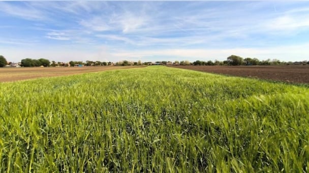
Muong La Nature Reserve, with a total area of over 17,000 hectares, is home to numerous species listed in the Vietnamese Red List. Its diverse ecosystem thrives due to its vast natural forest cover, which constitutes more than 70% of the total area. Managing and monitoring such a large area presents considerable challenges, especially in patrols, tracking wildlife traces, and preventing forest fires.

Once unusual traces are detected, photos are immediately sent through the SMART application, linked to specific coordinates. Photo: Duc Binh.
Previously, forest rangers had to rely on manual methods, using notebooks and paper maps, which made recording, storing, and analyzing data challenging.
To address these limitations, the Muong La Nature Reserve Management Board has implemented SMART (Spatial Monitoring and Reporting Tool). This is a data management and patrol reporting system. According to Mr. Bui Le Tru, Deputy Director of the reserve, the entire area is currently monitored by 21 members, including management staff. Since the reserve's forests are located in a tropical climate with rugged mountainous terrain and unpredictable weather conditions, patrol operations face numerous challenges.
Previously, notebooks and equipment carried during patrols often got wet and blurred, making it difficult to record and collect data. The implementation of SMART has helped forest rangers and community patrol team members enhance the effectiveness of their patrols. Instead of manually noting coordinates, taking separate photos, and analyzing them later, they can now collect data directly in the field, including images and coordinates, and instantly upload the information to the system for quick processing and analysis.
The integrated map within the application helps accurately determine patrol routes, minimizing errors and optimizing both patrol time and management oversight of on-the-ground patrol activities.
According to the leadership of the Nature Reserve Management Board, forest rangers and members of community patrol teams only need to take photos of their patrol groups and send the information to the specialized department. This allows management to track which areas have been patrolled and identify those that require more attention.

After one month of training, forest rangers have become proficient in using the features of the SMART application.
The application of technology has integrated satellite technologies (satellite maps, GPS positioning), enabling quick identification of specific locations. In case of incidents, information can be rapidly shared with management levels for timely assessment and response planning.
Every month, the management board organizes training sessions for local residents on forest protection, using SMART to store images and participant information. This helps track the level of awareness about forest conservation within the community and adjust training content accordingly.

The SMART tool installed on forest rangers' phones facilitates patrol and forest protection work. Photo: Quang Yen.
Although the implementation of SMART brings many benefits, it still faces certain challenges. Kháng A Trống, a forest ranger manager at Muong La Nature Reserve, shared: “The application’s data is quite large, which drains the battery on mobile devices, especially during patrols that last more than 4–5 days. To ensure sufficient battery life, we have to carry multiple backup chargers. In some remote forest areas with weak signals, data transmission is also affected to some extent.”
According to Mr. Trong, to overcome these challenges, forest rangers must carry extra backup batteries, and for longer patrols, some members even carry two phones to rotate usage. Currently, the management board is proposing that the Forest Protection Department invest in additional equipment, from phones to computers, to maximize the use of the SMART application. The unit also arranges for its members to participate in training courses and guidance sessions under various programs and projects organized by different organizations.
Translated by Kieu Chi
![Turning wind and rain into action: [9] Digitizing hydrometeorological data in response to climate change](https://t.ex-cdn.com/nongnghiepmoitruong.vn/608w/files/news/2025/06/17/z6704423696987_15fd32ffc26d590d204d520c9dac6786-nongnghiep-165943.jpg)
(VAN) Farmers have begun accessing hydrometeorological applications to adjust their cropping schedules, aiming to ensure productivity and adapt to climate change.
![Turning wind and rain into action: [8] Real-time salinity detection and early warning technology](https://t.ex-cdn.com/nongnghiepmoitruong.vn/608w/files/news/2025/06/17/z6704423696987_15fd32ffc26d590d204d520c9dac6786-nongnghiep-151127.jpg)
(VAN) Thanks to the integration of modern hydrological-hydraulic models, remote sensing technologies, and artificial intelligence, the accuracy of hydrological forecasting has significantly improved.
![Turning wind and rain into action: [7] Early disaster warnings help marine farmers minimize losses](https://t.ex-cdn.com/nongnghiepmoitruong.vn/608w/files/news/2025/06/17/z6704423696987_15fd32ffc26d590d204d520c9dac6786-nongnghiep-142942.jpg)
(VAN) In recent years, thanks to early disaster warnings and forecasting, marine farmers in Khanh Hoa province have been able to reduce risks and losses, thereby improving production efficiency.
![Turning wind and rain into action: [6] ‘Four on-the-spot’ disaster management software](https://t.ex-cdn.com/nongnghiepmoitruong.vn/608w/files/news/2025/06/17/e5a48259d6a262fc3bb3-nongnghiep-183800.jpg)
(VAN) By simply activating the scenario on the disaster management software, the relevant authorities immediately know how many households need to be evacuated, where to evacuate them to, and by what means of transportation…
![Turning wind and rain into action: [5] Hue applies modern technology in disaster forecasting](https://t.ex-cdn.com/nongnghiepmoitruong.vn/608w/files/news/2025/06/17/z6704423696987_15fd32ffc26d590d204d520c9dac6786-nongnghiep-093938.jpg)
(VAN) In Hue city, modern technology has recently been applied in meteorological and hydrological forecasting and warning, helping to reduce the damage caused by natural disasters.
(VAN) A cutting-edge farming technique being implemented on an experimental ranch in Arizona's Sonoran Desert has already saved a billion gallons of water over five years, according to Civil Eats.

(VAN) Poultry and pig production and the environment can be boosted through enhanced water technology, according to new research.
