May 24, 2025 | 16:19 GMT +7
Hotline: 0913.378.918
![]()
May 24, 2025 | 16:19 GMT +7
Hotline: 0913.378.918
![]()
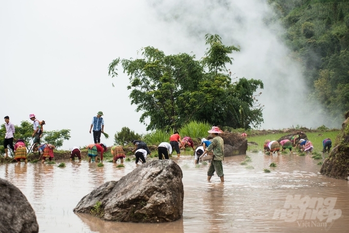
The “Heart-shaped terraced field” in Then Phan commune, Xin Man district has recently become a hot search on social networks. The person who made that work was Sin Van Tinh, a man of the Nung ethnic living in Then Phang. People like Sin Van Tinh, whether by accident, have contributed to the creation of scenic spots for their homeland.
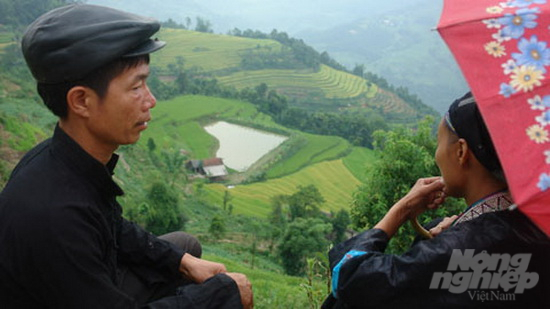
Sin Van Tinh (Then Phan village) and the heart-shaped terraced field created by him. Photo: Kien Trung.
More than ten years ago, during a business trip to Xin Man, a heart-shaped terraced field caught our attention. Curious, we went everywhere to inquire about the owner. That was how the predestined relationship with the Nung man came to be ever since.
The field is shaped like a giant heart of earth, beautiful to perfection, sitting on the top of the mountain, surrounded by the maze of terraced fields. It is the result of many seasons of earthwork, fortifying the bank, then cutting the edges, hoeing the bank, and so on.
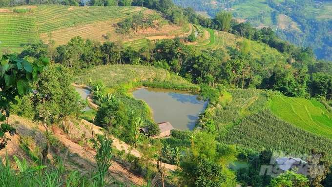
The heart-shaped terraced field in the middle of Then Phang village has existed for decades.
Its owner, Sin Van Tinh, once a Nung boy, now a man with gray hair. Photo: Kien Trung.
The heart-shaped field is one of the fields of Sin Van Tinh and his wife. Through so many seasons, each time, he and his wife reshape the field bit by bit, and a beautiful heart shape was formed without notice. We can’t know for sure whether it is luck for Sin Van Tinh or Then Phan village, because this masterpiece enchants visitors who come to Xin Man as they all find their way to admire the place.
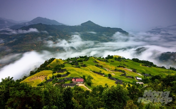
The terraced fields of Hoang Su Phi were granted the status of “heritage”. Photo: Huy Ha.
In the lowlands, through many generations, the rice cultivation skills turn into knowledge, then enhanced into culture and custom. That is the same case for terraced fields on the highlands. It is a farming method formed due to the steep hilly area, which cannot hold water.
The rice fields are leveled, from high to low, each level is covered with soil to create a bank with the purpose of retaining water, preventing erosion. A whole population of adjacent terraced fields, one after another, form a painting within mountains and forests.
Indigenous peoples, they are the owners, the creators of heritages. Photo: Huy Ha.
Hoang Su Phi has 3,720.6 ha of terraced fields spread throughout 24/24 communes and towns. In 2012, 1,380 ha of terraced fields of Ban Phung, Ban Luoc, San Sa Ho, Ho Thau, Thong Nguyen, Nam Ty, Ta Su Choong, Ban Nhuong, Po Lo, Thang Tin, Nam Khoa were recognized as National Landmarks. The undulating fields are winding as if they have legs to run, from the stream to the top of the mountain, even made more beautiful thanks to having the primeval forests, tea fields, rivers, streams, and villages as backgrounds.
The stone cavity fences in Can Chu Phin. Photo: Kien Trung.
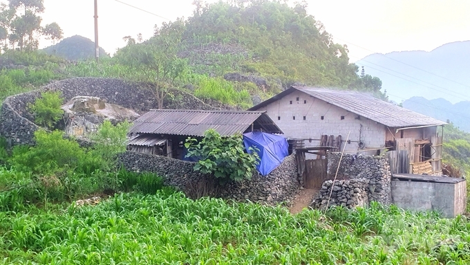
Whether it's just a small hamlet with a few roofs tucked under a deep valley, or a village with hundreds of roofs gathering under the canopy of an ancient Cunninghamia forest, it's not difficult to notice that there is always a stone fence surrounding each house. Orphaned stones, broken stones of all shapes and sizes are collected and cleverly arranged into stone fences high above the head, one on top of another without any need for anchors or adhesives.
Chairman of the commune Khau Vai Mua Mi Mua gave some explanation: The stone fence of the Hmong people has the effect of covering the house, separating the barn, and protecting the livestock. One special thing is that the stones lining the fence are orphaned stones in the fields. Each time the Hmong plows the field, they would collect the stone found by the plowshare so that they would not stumble next time, and then cleverly arranged them into a fence at home.


Along the stone fences, fates, lives, and even legacies were formed. Photo: Kien Trung.
In Can Chu Phin, a commune bordering Khau Vai (Meo Vac district), hundreds of beautiful and pristine stone fence walls are being promoted to become a tourist attraction. Visitors coming to the villages, looking at the rough, old stone fences will see the patience of generations and the feats that they left behind.

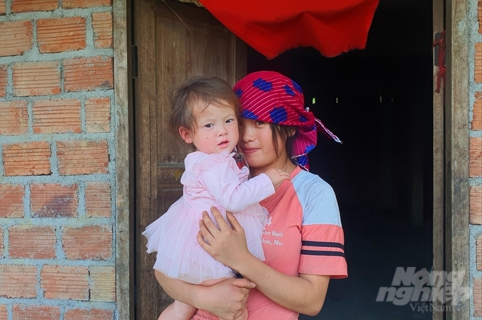
The people of Can Chu Phin’s rocky plateau. Photo: Kien Trung.
On October 3, 2010, Dong Van Karst Plateau became the first UNESCO geopark in Vietnam and the second in Southeast Asia. In 2014 and 2019, UNESCO re-recognized Dong Van Karst Plateau as a member of the UNESCO Global Geoparks Network for the period 2015-2018 and the period 2019-2022. In its profile, surely Ha Giang will not be able to "leave behind" this artificial scenic spot, made by indigenous people - the stone fences.
Translated by Samuel Pham
(VAN) The People's Committee of Tra Vinh province has approved an adjustment to the investment policy for the Green Hydrogen Plant project, increasing its area to approximately 52.76 hectares.
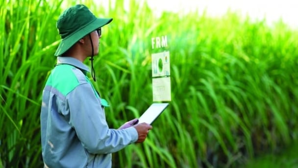
![Reducing emissions from rice fields: [2] Farmers’ commitment to the soil](https://t.ex-cdn.com/nongnghiepmoitruong.vn/608w/files/news/2025/05/05/dsc08881jpg-nongnghiep-140632.jpg)
(VAN) Clean rice cultivation model in Thuong Tan commune, Bac Tan Uyen district, is assisting local residents in achieving sustainable agriculture by substantially reducing costs, increasing productivity, and protecting the environment.
(VAN) At the conference to disseminate Resolution No. 68, AgriS introduced its digital agricultural ecosystem and reaffirmed its commitment to accompanying the Government in promoting private sector development and sustainable agriculture.
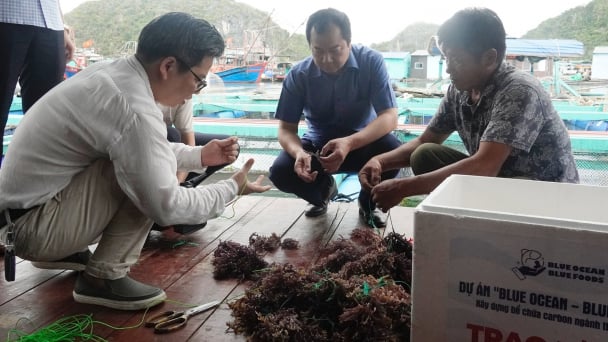
(VAN) 'Blue Ocean - Blue Foods' initiative is designed to restore marine ecosystems and establish sustainable livelihoods for local communities by cultivating a minimum of 1,000 hectares of cottonii seaweed in the first three years.
/2025/05/21/4642-3-112707_603.jpg)
(VAN) The V-SCOPE project has made direct contributions to three out of six pillars of the Comprehensive Strategic Partnership between Vietnam and Australia.
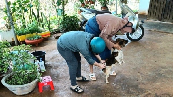
(VAN) Facing the threat of rabies spreading to the community, Gia Lai province urgently carries out measures to vaccinate dogs and cats on a large scale.
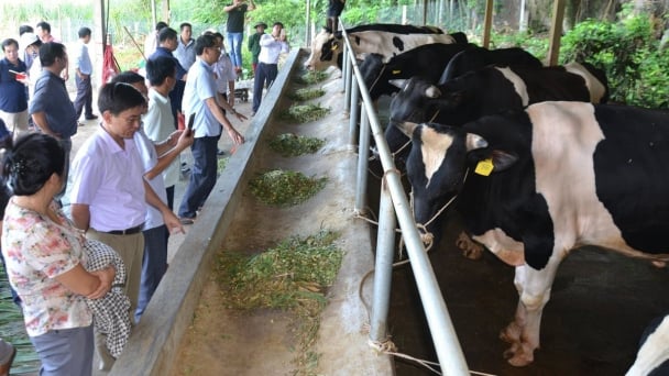
(VAN) Disease-free livestock farming not only protects livestock herds but also stabilizes production and livelihoods for many farmers in Tuyen Quang.
