June 12, 2025 | 17:01 GMT +7
Hotline: 0913.378.918
![]()
June 12, 2025 | 17:01 GMT +7
Hotline: 0913.378.918
![]()
Amid a global wave of digital transformation, remote sensing technology has emerged as a key tool in monitoring resources, protecting the environment, and promoting the development of modern agriculture. Under the close direction of the Ministry of Agriculture and Environment (MAE), Dr. Pham Minh Hai, Deputy Director General of the National Remote Sensing Department (NRSD), said that the unit is gradually realizing its goal of applying high technology to serve the nation’s sustainable development.

Dr. Pham Minh Hai, Deputy Director General of the National Remote Sensing Department. Photo: Khuong Trung.
According to Dr. Pham Minh Hai, Deputy Director General of the National Remote Sensing Department (NRSD), the department's current national remote sensing database is a vast geospatial database comprising nearly 100,000 satellite images. These images are collected from 16 different sensors, including VNREDSat-1 (Vietnam), SPOT6, KOMPSAT-3A, WorldView, Landsat, and, soon, Cosmo-SkyMed radar imagery (Italy).
The data has resolutions ranging from ultra-high (0.55 m) to medium (30 m), revisit frequencies from 2.5 to 5 days, and comprehensive coverage of Vietnam’s mainland, maritime zones, and islands. The volume of data grows steadily by approximately 20% annually, meeting the needs of multi-sectoral monitoring from agriculture and environment to national defense and security.
This database is a critical foundation for deploying intelligent monitoring programs, supporting disaster analysis and early warning, climate change response, and environmental protection.
In recent years, the NRSD has implemented a series of remote sensing applications, delivering significant practical effects.

Delegates attend the seminar on Environment, Water Resources, and Remote Sensing on May 10, within the framework of the conference to implement the “Action Plan for Resolution No. 57-NQ/TW of the Politburo on breakthrough development in science, technology, innovation, and national digital transformation” in the agriculture and environment sector. Photo: Khuong Trung.
During the historic Typhoon Yagi’s landfall in Northern Vietnam in September 2024, the Center for Environmental Monitoring coordinated the operation of the Sentinel Asia system, promptly providing information for command and rescue.
Remote sensing technology has been applied to create large-scale topographic maps of the Spratly and Paracel Islands in remote island waters, supporting the development of the ocean economy and ensuring national defense and security. Meanwhile, in the Red River and Mekong River basins, satellite altimetry is used to monitor reservoir water levels, supporting flood forecasting and water regulation.
Additionally, remote sensing technology has been deployed to monitor land use planning across 63 provinces and cities, track forest changes for the national forest inventory, and observe ground subsidence in Hanoi, Ho Chi Minh City, and the Mekong Delta with centimeter-level precision. Notably, remote sensing data has also been integrated to calculate greenhouse gas emissions following IPCC guidelines, marking a great step forward in implementing Vietnam’s emission reduction commitments.
According to Resolution 57-NQ/TW, the Party and State have clearly stated that investment in science and technology is an investment in development. This presents a golden opportunity for the remote sensing sector to break through, taking advantage of investment resources and new policies to implement innovation and strongly applying Artificial Intelligence (AI), Big Data, the Internet of Things (IoT), cloud computing, and blockchain technology in solving rapid monitoring and automation problems in the agriculture and environment sector.
The Resolution also reaffirms the NRSD’s role in performing critical tasks, such as monitoring growing areas, estimating yields of key crops, forecasting floods, droughts, and saltwater intrusion, supervising diseases, and assessing soil and water quality.
However, the remote sensing sector faces numerous challenges alongside these vast opportunities.
In terms of human resources, there is still a shortage of experts with deep expertise in areas such as remote sensing image analysis, Artificial Intelligence (AI), and Geographic Information Systems (GIS). Many current university training programs have yet to meet practical demands.

The remote sensing sector is facing numerous challenges, of which the investment costs in remote sensing technology are a major barrier.
Regarding technical infrastructure, the national remote sensing database has not been upgraded to meet the level 3 information security standard, raising concerns about data security. Besides, the fragmented data utilization across different Ministries and branches leads to wastefulness and a lack of synchronous management.
Notably, the investment costs in remote sensing technology, from satellite production to data acquisition, storage, and processing, remain a major barrier, requiring a more effective strategy for mobilizing and allocating resources.
To enhance the application of remote sensing technology for sustainable development, the NRSD has proposed that the Ministry of Agriculture and Environment consider approving the project “Promoting the application of remote sensing and artificial intelligence in building an intelligent monitoring system for certain agricultural and environmental fields to support green growth and sustainable development,” which is implemented in 2026.
The project is built on the spirit of Resolution 57-NQ/TW, Resolution 193/2025/QH15, and Resolution 71/NQ-CP. It aims to integrate modern digital technologies into the agricultural and environmental monitoring systems, thereby enhancing governance capabilities and supporting swift and effective decision-making in line with the national digital transformation strategy.
Remote sensing is no longer a “technology of the future” but an indispensable tool for sustainable management of agriculture, resources, and the environment today. With a strategic vision and methodical investment, Vietnam can fully master and effectively leverage remote sensing technology, making a significant contribution to the development of a green, modern, and sustainable economy.
Translated by Thu Huyen
(VAN) Blue carbon is receiving attention for its rapid absorption capacity and vast potential. It represents a promising nature-based solution to respond to climate change.
/2025/06/11/3507-1-161904_583.jpg)
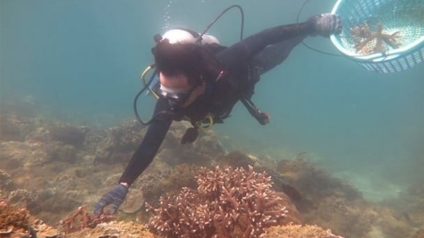
(VAN) Seagrass beds and coral reefs serve as 'cradles' that nurture life in the ocean depths, creating rich aquatic resources in Vietnamese waters.
![Turning wind and rain into action: [1] Forecasting for farmers](https://t.ex-cdn.com/nongnghiepmoitruong.vn/608w/files/news/2025/06/11/e5a48259d6a262fc3bb3-nongnghiep-111919.jpg)
(VAN) Weather is no longer just a matter of fate. Forecasts have now become an essential companion for farmers in every crop season.
/2025/06/10/2501-3-082025_983.jpg)
(VAN) Mr. Le Hoang Minh, Head of Vinamilk's Net Zero project, recently shared insights on the integration of production, energy, and technology in Vinamilk’s green transition journey.
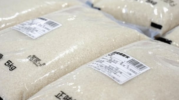
(VAN) Over half of large-scale rice producers feel that store prices for rice are 'too high', indicating that many of them share concerns with consumers about the elevated cost of the staple food in Japan.
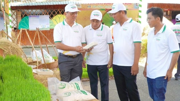
(VAN) Dong Thap has launched a meeting in response to the Action Month for the Environment under the theme 'Live Green - Join Hands for a Green Economy' at Tram Chim National Park.
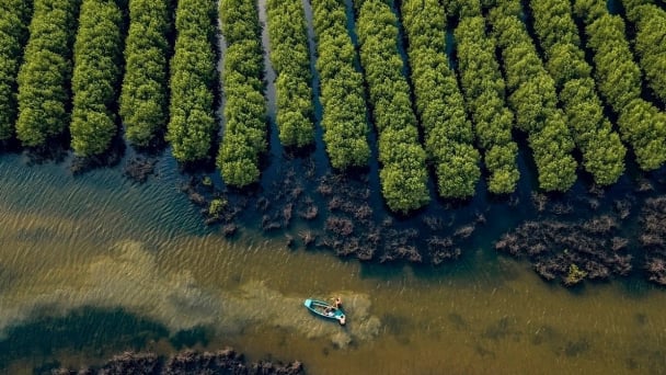
(VAN) The ocean has the capacity to absorb millions of tons of carbon, provided that mangrove forests, coral reefs, and biodiversity are protected.
