June 18, 2025 | 23:42 GMT +7
Hotline: 0913.378.918
![]()
June 18, 2025 | 23:42 GMT +7
Hotline: 0913.378.918
![]()

Dr. Hoang Hiep (far right), Director of the Academy for Green Growth under the Vietnam National University of Agriculture, handing over the project to a representative of An Duong district. Photo: Dinh Muoi.
The project, implemented by An Duong district (Hai Phong city) in collaboration with the Academy for Green Growth under the Vietnam National University of Agriculture over six months from August 2023 to January 2024, includes three specialized reports and seven sector-specific maps. An Duong district was the first region in Hai Phong to implement and complete this project.
The project's content focuses on building a database for the status, quality, and potential use of land; establishing an online management system for land resource and agricultural planning data in An Duong district; and establishing planning for ecological urban agriculture in association with tourism development in the district until 2030, with a vision towards 2045.
During the project's implementation, various sectors, local governments, and agencies have closely coordinated to accomplish multiple project components with a significant workload, including: gathering information and document; conducting surveys, monitoring, and water and air sample collection.
Notably, specialized parties have collected nearly 500 soil and agrochemical samples, and evaluated the quality of water and air environments. The collected samples were analyzed in accordance with quality standards.

Chili production model in An Hoa Commune, An Duong District. Photo: Dinh Muoi.
In addition, stakeholders conducted surveys and evaluations across 16 communes and towns in An Duong district regarding the state of agricultural production land usage, value chains, industry linkage, and agricultural production activities; the current level of science, technology application and digital transformation in agricultural production; and the results of the new rural construction initiative.
Following environmental sampling and analysis activities, the Academy for Green Growth processed internal data; analyzed and evaluated land potential and suitability; forecast development trends; and developed a series of maps to support planning and sustainable development of agricultural production areas.
According to the An Duong District People's Committee, the project was systematically and scientifically developed in compliance with the local and Hai Phong city's overall development plans. Notably, all of the project's data and maps have been digitized, forming an online data system connected to the district's online Decision Support System (DSS). This network enables convenient access and utilization of information, thereby facilitating the decision-making process by management authorities with regards to the selection of selecting suitable agricultural production areas and production strategies.
Le Van Cuong, Vice Chairman of the An Duong District People's Committee, stated that in addition to establishing a city administrative agency and promoting urban development, the district has prioritized land allocation for agricultural development and preservation of traditional craft villages.
Moreover, An Duong district has collaborated with Hai Phong city's departments and sectors to restore and propagate Dong Du orange and camellia in Dang Cuong Commune; develop gladiolus flowers in Dong Thai Commune; implement crop structure changes with numerous effective agricultural production models; among other activities.

The development of camellia production in Dang Cuong Commune, An Duong District is a pilot model within the framework of the project. Photo: Dinh Muoi.
However, the agricultural land area in An Duong district is gradually shrinking due to growing urban development demands. On the other hand, local agricultural production activities are fragmented, outdated, economically inefficient, and lack effective linkages. Furthmore, local agricultural products lack a regional identity, and production production is affected by weather and climate changes, diseases, and environmental pollution. Consequently, it is crucial to promptly assess the state of the local agricultural sector, with the aim of guiding agricultural development planning.
The project will implement several pilot agricultural production models based on the analysis and evaluation of land status and potential. These pilot models include: a high-quality flower production model in combination with eco-tourism in Tan Tien commune; a high-quality rice production model in Bac Son commune; a mushroom production model in Hong Phong commune; a VietGAP-compliant vegetable and fruit production model in net houses in An Hoa commune; and a high-yield, high-quality potato production model in Tan Tien, An Hong, and Dai Ban communes.
“Thanks to the publicly available digital mapping system, local residents and businesses can easily access land potential and planning information. Consequently, this system encourages organizations, individuals, and businesses to effectively and sustainably invest in agricultural production,” remarked Vice Chairman Le Van Cuong.
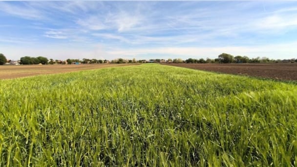
An Duong district is currently managing nearly 5,000 hectares of agricultural land area, with an average annual production value of 1 trillion Vietnamese dong. The district's fertile soil and abundant water resources facilitate the development of a modern, advanced and high-quality agricultural sector.
Translated by Nguyen Hai Long
![Turning wind and rain into action: [9] Digitizing hydrometeorological data in response to climate change](https://t.ex-cdn.com/nongnghiepmoitruong.vn/608w/files/news/2025/06/17/z6704423696987_15fd32ffc26d590d204d520c9dac6786-nongnghiep-165943.jpg)
(VAN) Farmers have begun accessing hydrometeorological applications to adjust their cropping schedules, aiming to ensure productivity and adapt to climate change.
![Turning wind and rain into action: [8] Real-time salinity detection and early warning technology](https://t.ex-cdn.com/nongnghiepmoitruong.vn/608w/files/news/2025/06/17/z6704423696987_15fd32ffc26d590d204d520c9dac6786-nongnghiep-151127.jpg)
(VAN) Thanks to the integration of modern hydrological-hydraulic models, remote sensing technologies, and artificial intelligence, the accuracy of hydrological forecasting has significantly improved.
![Turning wind and rain into action: [7] Early disaster warnings help marine farmers minimize losses](https://t.ex-cdn.com/nongnghiepmoitruong.vn/608w/files/news/2025/06/17/z6704423696987_15fd32ffc26d590d204d520c9dac6786-nongnghiep-142942.jpg)
(VAN) In recent years, thanks to early disaster warnings and forecasting, marine farmers in Khanh Hoa province have been able to reduce risks and losses, thereby improving production efficiency.
![Turning wind and rain into action: [6] ‘Four on-the-spot’ disaster management software](https://t.ex-cdn.com/nongnghiepmoitruong.vn/608w/files/news/2025/06/17/e5a48259d6a262fc3bb3-nongnghiep-183800.jpg)
(VAN) By simply activating the scenario on the disaster management software, the relevant authorities immediately know how many households need to be evacuated, where to evacuate them to, and by what means of transportation…
![Turning wind and rain into action: [5] Hue applies modern technology in disaster forecasting](https://t.ex-cdn.com/nongnghiepmoitruong.vn/608w/files/news/2025/06/17/z6704423696987_15fd32ffc26d590d204d520c9dac6786-nongnghiep-093938.jpg)
(VAN) In Hue city, modern technology has recently been applied in meteorological and hydrological forecasting and warning, helping to reduce the damage caused by natural disasters.
(VAN) A cutting-edge farming technique being implemented on an experimental ranch in Arizona's Sonoran Desert has already saved a billion gallons of water over five years, according to Civil Eats.

(VAN) Poultry and pig production and the environment can be boosted through enhanced water technology, according to new research.
