May 24, 2025 | 04:33 GMT +7
Hotline: 0913.378.918
![]()
May 24, 2025 | 04:33 GMT +7
Hotline: 0913.378.918
![]()

At the beginning of the rainy and stormy season in 2023, Can Tho City continuously recorded serious landslides. Photo: Kim Anh.
Landslides and flood tides are two types of existing natural disasters in Can Tho City in 2023. In May 2023 alone, Can Tho City recorded three consecutive serious landslides occurring in Thoi Lai district and Binh Thuy district.
Currently, the Can Tho Department of Agriculture and Rural Development is strengthening solutions to inspect and review the area of riverbanks and canals at the beginning of the rainy and stormy season in 2023. At the same time, the unit also has plans to mobilize and relocate people in landslide-risk areas and build temporary and biological embankments to minimize the occurrence of landslides.
At the landslide point in Thoi Thuan area, Thoi An Dong ward, Binh Thuy district, which occurred on May 19, the traffic route, along Tra Noc river and about 320m from Tra Noc 2 bridge towards KH8 canal, collapsed into the river and was completely dismembered. The length of the landslide section is about 50m; the length of the landslide-risk section is 50 m; and the depth of the landslide point is about 5m.
Binh Thuy district government has implemented a ban on the 1T load sign and the notice board "area at risk of riverbank landslide" to warn, manage traffic and boats anchored to the above locations, and at the same time limit the impact on the work.

Mr. Nguyen Ngoc He, Vice Chairman of the Can Tho People's Committee, requested to review the entire riverbed depth at the landslide-occurring points and plan emergency solutions. Photo: Kim Anh.
Recently, the Binh Thuy People's Committee has written to the Can Tho People's Committee to have a plan to support and overcome the above-mentioned landslide point by building a solid concrete embankment, ensuring life, property, and traffic for people. Besides, the landslide point is showing signs of encroaching on the shore, threatening the safety of people and the houses of households living inside the route.
In recent years, the landslide situation in Can Tho City in particular and the Mekong Delta in general has become alarming, not only in the rainy and stormy season but also in the dry season.
In Thoi Lai district, within four days, two landslides occurred in Tan Thanh commune. Specifically, on May 20, the 55-meter road along the banks of the O Mon river in Thoi Phuoc 1 hamlet suddenly collapsed and attacked 8m deep into the bank, risking further landslides about 50m long. On May 24, Thoi Khanh hamlet also recorded a 40-meter road landslide.
In addition to planning to overcome the consequences of landslides, the Thoi Lai People's Committee has proposed that the Can Tho People's Committee develop an investment plan to respond to landslides according to the path at 13 points located on the O Mon River section with a length of over 7km that currently have very high potential for landslides.
Recently, during a field trip to survey landslide points, Mr. Nguyen Ngoc He, Vice Chairman of the Can Tho People's Committee, asked relevant authorities to review the entire riverbed depth at the landslide-occurring points. From there, plan emergency solutions to overcome the problem, which can include the construction of a bridge or a solid embankment to ensure stable lives in the affected area.
According to the Can Tho Department of Agriculture and Rural Development, from 2010 to 2022, the city had 262 landslides with a total length of approximately 10,000 m, and 94 houses were completely damaged. The landslide also left four people dead and five injured. At present, the evolution of riverbank and canal landslides in the city is still complicated and unexpected, especially in areas with high traffic density and river sections located at the intersection between river flows and tides, etc.
In order to increase the resilience of Can Tho city to the risk of flooding and improve urban management capacity to adapt to climate change, since June 2016, the city has launched the Project on Can Tho City Development and Enhancing Urban Adaptability. The project is funded by the World Bank (WB) and aims to strengthen the capacity of the Can Tho city government in disaster risk management.

Mr. Tran Viet Truong, Chairman of the Can Tho People's Committee, checked the construction progress of some works under the Project on Can Tho City Development and Enhancing Urban Adaptability. Photo: Kim Anh.
On May 25, Mr. Tran Viet Truong, Chairman of the Can Tho People's Committee, had a field trip to check the construction progress of some works under the above-mentioned project, such as the tender package to renovate drainage systems in the center of Ninh Kieu district and the tender package for the construction of Tran Hoang Na bridge.
According to the ODA Project Management Board (under the Can Tho People's Committee), the tender package CT3-PW-1.11: Renovating drainage system in the center of Ninh Kieu district will be implemented on 34 roads across the district. Currently, the construction progress of the completed culverts reaches about 65% of the work volume. With the package CT3-PW-2.4: Construction of Tran Hoang Na Bridge, which started from September 2020 until now, the workload has reached over 77%.
Regarding the Cai Son embankment project, Mr. Tran Viet Truong suggested that the Ninh Kieu People's Committee must ensure the handover of the site to the construction unit in June to ensure the schedule. This is a project that is expected to effectively solve the landslide problem for the section from Cai Son bridge, An Binh ward, Ninh Kieu district, to the point adjacent to the anti-landslide embankment project in My Khanh market area, Phong Dien district.

The embankment works to combat landslides and saltwater intrusion and cope with climate change in the Cai Son canal area. Photo: Kim Anh.
With a large remaining workload and the current slow construction progress, Mr. Tran Viet Truong asked the ODA Project Management Board, contractors, and construction units to speed up the progress, focus force on it, and report difficulty to find solutions.
In particular, quickly solve problems related to materials and unify construction methods for the remaining work items to avoid prolonging them. During the construction process, the units must pay attention to ensuring absolute labor safety, proper construction techniques, and strict documentation in accordance with the process.
Chairman Tran Viet Truong suggested that all of the above work items be completed before September 2, 2023, ensuring benefits for people and convenience for travel, trade, and activities during the rainy and stormy season in 2023 and improving the capacity of Can Tho city to cope with climate change.
Translated by Huyen Vu Thu
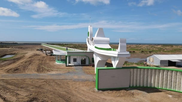
(VAN) The People's Committee of Tra Vinh province has approved an adjustment to the investment policy for the Green Hydrogen Plant project, increasing its area to approximately 52.76 hectares.
![Reducing emissions from rice fields: [2] Farmers’ commitment to the soil](https://t.ex-cdn.com/nongnghiepmoitruong.vn/608w/files/news/2025/05/05/dsc08881jpg-nongnghiep-140632.jpg)
(VAN) Clean rice cultivation model in Thuong Tan commune, Bac Tan Uyen district, is assisting local residents in achieving sustainable agriculture by substantially reducing costs, increasing productivity, and protecting the environment.

(VAN) At the conference to disseminate Resolution No. 68, AgriS introduced its digital agricultural ecosystem and reaffirmed its commitment to accompanying the Government in promoting private sector development and sustainable agriculture.
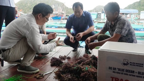
(VAN) 'Blue Ocean - Blue Foods' initiative is designed to restore marine ecosystems and establish sustainable livelihoods for local communities by cultivating a minimum of 1,000 hectares of cottonii seaweed in the first three years.
/2025/05/21/4642-3-112707_603.jpg)
(VAN) The V-SCOPE project has made direct contributions to three out of six pillars of the Comprehensive Strategic Partnership between Vietnam and Australia.

(VAN) Facing the threat of rabies spreading to the community, Gia Lai province urgently carries out measures to vaccinate dogs and cats on a large scale.
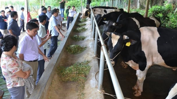
(VAN) Disease-free livestock farming not only protects livestock herds but also stabilizes production and livelihoods for many farmers in Tuyen Quang.
